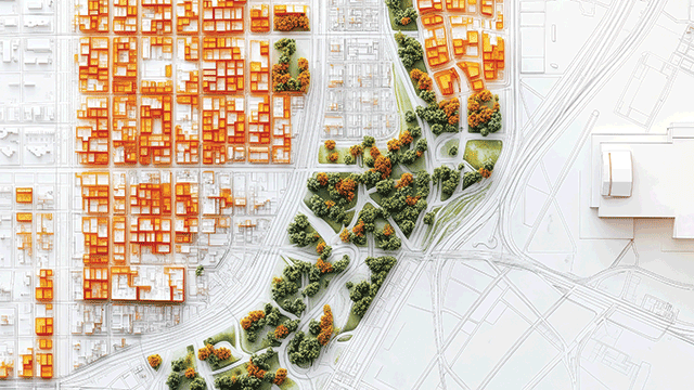
COMMENT Town planning in England has largely been analogue since the system was created almost 80 years ago. For much of this time it has been a paper-based industry, heavily reliant on professional judgment and lacking comprehensive and joined-up data about places. It has also become increasingly hobbled by resource constraints in local government.
At the same time, planning has arguably been thrust into the middle of increasingly complex environmental, social, and economic challenges. These include helping to address climate change, creating socially inclusive and healthy places, and addressing the national housing crisis by allocating sufficient land to meet needs in the right places and at the right time.
This analogue system has to be ripe for digitisation as its remit becomes increasingly complex and bound up with the success (or otherwise) of national and international goals around emissions reductions, climate change, protecting ecosystems, economic resilience, and equality.
Poorly-equipped
All of the big issues of our times require data, analytics, modelling and testing of solutions. An analogue planning system is poorly equipped to address these challenges.
There has been some digitisation over the past 20 years, however. Those using the planning system will be familiar with the online submission of applications, being able to view and download PDFs of local plan maps and engaging with online consultations. The pandemic has also sped up the adoption of digital-led consultations on plans and applications.
This is good as far as it goes, but these are pretty basic functions; essentially web portals, downloads and document sharing.
As it stands, there is no standardisation in approaches to digital planning across the 300-plus local authorities in England. This makes the system more complex and difficult to navigate than it needs to be. It also makes digital data hard to collect and use. Much of the spatial and location data collected in the planning system is also only used once – a missed opportunity for joined up thinking and decision making around development and infrastructure.
The government has recognised the opportunity to improve the speed, efficiency, and outcomes of the planning system by further digitisation. Some local authorities have already been piloting digital approaches to development management and the Planning Inspectorate is investigating the use of artificial intelligence in some of its functions.
Digital local plans
Government is also well progressed with work to create a new generation of digital local plans, which will provide clarity on the standard and format of digital spatial data required. This is not some distant dream of a digital future but a key part of wider planning reform which is underway. We could see this new generation of all-digital local plans starting to emerge in the next couple of years.
One of the big opportunities that digitisation of the planning system will bring is the generation of valuable spatial data about places and how they are planning to grow, adapt and change. There is a huge opportunity to use this data to provide for more effective, joined-up and responsive planning for power and utilities, active travel and mobility infrastructure, social infrastructure and access to green space.
This data can also help with planning for not just net-zero buildings but net zero-places.
Democratisation
Another big prize is the democratisation of the planning system. The analogue system can be confusing and difficult for people to engage with. As the system moves online there is the opportunity to specifically design for user friendliness and to create far clearer pathways to finding information, understanding the impact of development, having a say and receiving updates.
The government has committed to providing accessible location data that is high quality, reusable and interoperable. This will all be freely available to entrepreneurs to commercialise and create new applications that help plan better. It will also provide location data for non-real estate industries to commercialise.
For the real estate sector, there are benefits associated with better quality location and property data which can inform site finding, appraisal, acquisitions, and planning promotions.
Digitisation can create more certainty, noting the move towards standardisation of digital local plans and the evidence that informs them. Sound too good to be true? Far from a dream, digitisation of the planning system is already underway and there is more to come.
Richard Laming is a senior director at Turley


