

Guy Fetherstonhaugh QC and Mathew Ditchburn introduce a new protocol for use in boundary disputes
In our introduction to the Property Protocols website, which we launched as a free resource to property practitioners three years ago, we expressed the hope that the protocols would become a suite of documents that would outline, in readily understandable prose, a series of practical steps that parties should consider taking if they wish to avoid or minimise property disputes.
Our first two protocols sought to outline the steps that should help to prevent the spats that can arise on the occasion of dealings with leasehold title, and alterations to leased properties.
Not all disputes are avoidable, but our strategy is to help parties to eliminate the arguments about process that usually bedevil litigation, and allow them to concentrate their time, energy and money on the substance of the issues in dispute.
We have many more ideas about other landlord and tenant protocols which we intend to develop and add to our stable, but for our third protocol we turn to a different area of legal contention: the boundary dispute.
The reasons for a boundary dispute protocol
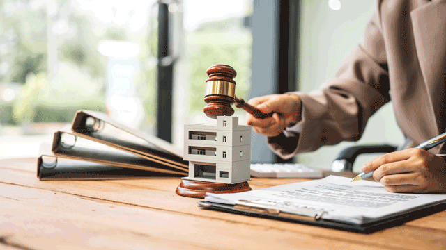
Why have a boundary dispute protocol? Well, here are a few reasons which will be familiar to anyone who has litigated a boundary dispute. First, boundary disputes are often ruinously expensive if fought in court, and usually eclipse the value of the land in dispute. As Ward LJ observed in Thompson v Collins [2009] EWCA Civ 525; [2009] PLSCS 124: “…that is the insidious nature of a boundary dispute. The lesson is never learnt that those who fight for their principles frequently end up paying for them”. Our protocol should help “to avoid what is almost always the wholly disproportionate cost and stress of having to litigate a boundary dispute [and] the blood, toil and sweat which has been devoted to this litigation”, to quote Briggs LJ in Parmar v Upton [2015] EWCA Civ 795; [2015] PLSCS 231.
Secondly, boundary disputes are usually prime candidates for early compromise: this is something which the structured approach set out in the protocol (including alternative dispute resolution) encourages. As Norris J said in Bradley v Heslin [2014] EWHC 3267 (Ch); [2014] PLSCS 278, advocating the use of negotiation, expert determination or mediation, “those embroiled in [boundary disputes] need saving from themselves”.
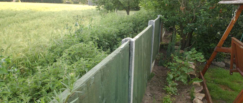
Thirdly, boundary disputes usually entail a mix of familiar themes, such as the status of an Ordnance Survey plan attached to a conveyance “for the purposes of identification”, the inferences that may properly be drawn from physical features of the land existing and known at the date of the conveyance, or the ownership of a boundary structure.
While the proper interpretation of such factors is meat and drink to some lawyers and surveyors, they are often baffling to the parties, who may rely instead on preconceived but erroneous notions. Again, the use of a protocol, supervised by properly qualified professionals, should identify and resolve the errors at an early stage, before the dispute has become heated.
Fourthly, the most intractable boundary disputes usually involve people, rather than corporations, each defending their piece of turf, with increasing acrimony. Litigation almost always worsens the situation. As Mummery LJ said in Pennock v Hodgson [2010] EWCA Civ 873; [2010] PLSCS 223: “In many boundary disputes both sides ultimately lose something that might have been secured in a compromise… The unfortunate consequences of a case like this are that, in the absence of any compromise, someone wins, someone loses, it always costs a lot of money and usually generates a lot of ill-feeling that does not end with the litigation. None of those things are good for neighbours.”
In Ellett-Brown v Tallishire Ltd (29 March 1990, unreported), Lloyd LJ added: “once good relations have broken down, bitter enmity so often sets in. Anyone who has ever tried a typical boundary dispute, with all the expense of spirit which such disputes invariably entail, not to mention the expenditure of time and money, will recognise at once what I mean.” To put it bluntly, at the end of your dispute, the neighbour who you have just worsted, or by whom you have just been worsted, is still on the other side of the fence.
Fifthly, the use of the protocol should result in disputes being healed and resolved permanently by enforceable and precise agreements as to the boundary. As Megarry J said in Neilson v Poole (1969) 20 P&CR 909: “a boundary agreement is, in its nature, an act of peace, quieting strife and averting litigation, and so is to be favoured in the law”.
Sixthly, we are not alone in wishing to promote the use of ADR in boundary disputes. In 2012, the Property Boundaries (Resolution of Disputes) Bill was published, proposing a mandatory independent expert determination system for the resolution of boundary disputes, based on the Party Wall etc. Act 1996. The bill was introduced in the House of Lords in 2015, but the general election halted its progress. It was reintroduced in July 2017, this time including provision for the RICS to issue a code specifying best practice in the preparation of plans and documents under the bill.
While welcoming any attempt to lessen the flow of ruinous litigation over small pieces of land, we have serious reservations about the aim and structure of the bill. Two things strike us in particular. First, boundary disputes are not usually just matters of measurement and consideration of features – matters well within the practical experience of surveyors – but often involve detailed interpretation of plans and conveyances, and the application of legal presumptions – matters more suited to the skillset of a lawyer.
Secondly, we doubt whether it is right to force parties to forgo their legal rights and submit disputes to independent expert determination: consensual methods of ADR (also including supervised negotiation, arbitration and mediation) seem to us to be the better route. Comparisons with the Party Wall etc. Act 1996 are not altogether helpful: first and foremost, that is an act enabling building owners to carry out works affecting their neighbour’s land. The dispute resolution procedure it provides is a qualification of that right and a quid pro quo designed to protect the affected neighbour.
The elements of the boundary disputes protocol
And so to the documents. In the usual way, we have produced a protocol, which seeks to guide the parties’ behaviour to a successful outcome, as well as a guidance note. In addition to this, David Powell FRICS of PSL Chartered Surveyors has kindly produced a supplementary guidance note on what to expect from surveyors in boundary disputes. We summarise each document in turn.
The protocol
The stated aim of the protocol is to provide a process “which seeks to ensure that neighbours exchange sufficient information in a timely manner to minimise the scope for disputes between them; and to enable any such disputes to be readily resolved, keeping costs to a minimum”.
Once the parties in dispute have subscribed to the protocol, they must then take the steps set out in a prescribed timetable. These include: (1) the exchange of all relevant title information in each party’s possession; (2) the identification of the first conveyance by which their properties passed into separate ownership; (3) agreement as to the steps to be taken to find that conveyance if they do not have it; and (4) in the event that an adverse possession claim is made, whether to proceed to investigate the paper title position, the adverse possession claim/boundary agreement, or both.
If the claim cannot be settled at this stage, the protocol requires the parties to decide whether they can reach an acceptable resolution by direct negotiation or with the assistance of a mediator, before incurring the cost of legal and surveying advice, bearing in mind the value of the land at stake, even if that means accepting something less than they would ideally like.
In preparation for such a negotiation or mediation, the parties should ascertain (preferably by asking the advisers that they will retain if the dispute cannot be settled) what costs they will incur if the matter cannot be settled.
Assuming they wish to proceed to the next stage (having by now identified the first conveyance), each party must consider what evidence (eg, old photographs/aerial photographs) they will be able to adduce about the physical features which existed on the ground at the date when the first conveyance occurred (and any other relevant issues of fact), and then exchange that evidence.
If the first conveyance provides accurate plans, but the parties still cannot settle the dispute, it is likely that expert surveying evidence will be needed. In some cases, other types of expert evidence will also be needed, for example, to assist in the interpretation of aerial photographs.
The protocol goes on to make the point that, in most cases where boundaries between private gardens are disputed, it will not be proportionate for the parties to have an expert each. In these cases, an expert should be jointly appointed, and should be asked to produce a short report within a further four weeks. This should:
(a) include an accurate, computerised plan of the physical features existing on the ground at the date of inspection;
(b) plot onto that plan the line shown on the first conveyance plan, or, if there is more than one possible interpretation, the various possible boundary lines;
(c) explain why the various possible boundary lines arise – ie what interpretation of the first conveyance and/or the other evidence leads to that line being chosen; and
(d) produce any photographs which the expert considers will assist.
In other cases, it may be proportionate for the parties to instruct an expert each. Short reports should be exchanged within four weeks after instructions are provided to single experts. The experts should, within two weeks of the exchange of reports, have a discussion in order to identify to what extent they are able to agree, and agree a short summary of their discussion which should be provided to both parties.
Where either party alleges that it is in adverse possession of the disputed land, the protocol requires that each party should provide to the other party all relevant documentary evidence and information about who the witnesses of fact will be and what they will say. Relevant documentary evidence might include photographs, aerial photographs, and invoices for works done on the boundary.
In some cases here too, expert evidence may be necessary – for example, if there is a difference of interpretation of plans, or there are aerial photographs. The same process for appointment, inspection, discussion and conclusion apply here in the same way.
The protocol deals in detail with the process for achieving a final resolution of the dispute. In essence, the parties must meet again within two weeks of the date on which the last of the steps set out above is taken, in order to see whether they are able to agree the boundary. If possible, that meeting should take place at the location of the disputed boundary with the expert (or experts if more than one was instructed). Any discussions should be on the basis that they are “without prejudice” and so cannot be relied on in subsequent legal proceedings, if a binding agreement is not reached.
If they cannot reach an agreement in principle, the parties should consider whether some form of alternative dispute resolution procedure would be more suitable than litigation and, if so, endeavour to agree which form to adopt.
The options for resolving disputes without litigation include arbitration by a suitably qualified and experienced lawyer or surveyor agreed on by the parties or appointed in default of agreement from the Property Panel of the Chartered Institute of Arbitrators by the president of that institute; expert determination by an independent third party (for example, a barrister, solicitor or surveyor experienced in the relevant field); or mediation.
If the parties cannot reach agreement after complying with the protocol, then the final step will be for the dispute to be referred to the appropriate tribunal for determination; either the court or (by way of a Land Registry application) the First-tier Tribunal (Property Chamber) (Land Registration). The protocol cautions that the parties should be aware of the substantial costs consequences of taking such action and that the risk of paying costs may be greater if they have failed to take steps equivalent to those set out in the protocol, particularly alternative dispute resolution.
The protocol rightly takes some care in outlining the importance of formalising any agreement that is reached, including how to document the agreement, and how to mark the line of the agreed boundary. It advises that in all cases a written document setting out what has been agreed will be required.
The parties should annex an agreed plan to a written agreement and record that in order to settle a dispute as to the location of the boundary, the parties have agreed that it should run along the line shown, for example, coloured red on the plan annexed. It will often be wise to have the agreement drawn up by a lawyer. Each party should then apply to the Land Registry to note the agreement against their titles.
The guidance note
This is a short but helpful document which amplifies the reasons for the approach taken by the protocol. It explains first why Land Registry title plans are usually unhelpful in depicting the exact location of the boundary. It goes on to emphasise the importance of locating the first conveyance:
“The start point, and in many cases the end point, for determining the location of the boundary is the interpretation of this First Conveyance, in light of the words used and the physical features present on the ground at the time.”
The guidance note goes on to explore the position concerning historic boundary agreements and adverse possession claims, before ending with advice concerning the importance of ensuring that any agreement settling the dispute is clear and enforceable.
Supplementary guidance note
This note is designed to help those involved in boundary disputes understand the role of their surveyor and what they can be expected to do. It also gives surveyors an indication of what has been found in practice to be a sensible approach.
It draws on the considerable experience of David Powell as a well-known expert surveyor on such matters, and stresses the importance of such practical measures as rigorous inspection, measurement, recording and analysis. It goes on to set out a series of tips for surveyors meeting their clients and opposite numbers, with a view to a rapid and painless end to the dispute.
Damage limitation
We think that this latest protocol will help to eliminate or minimise the damaging friction that is inherent in boundary disputes, and steer the parties towards a successful compromise without resort to ruinously expensive proceedings – or at least to proceedings in which the issues for debate have been confined. The Property Litigation Association agrees with us, and has been kind enough to add its input and considerable support to this protocol.
The protocol, guidance note and supplementary guidance note can be accessed free of charge on the Property Protocols website.
You can also download a Word version of each document directly using the below links:
- Boundary disputes protocol
- Boundary protocol guidance note
- Boundary protocol supplementary guidance note
Guy Fetherstonhaugh QC of Falcon Chambers and Mathew Ditchburn of Hogan Lovells International LLP are two of the authors of the Boundary Dispute Protocol. Its other authors are: Stephanie Tozer and Jonathan Karas QC of Falcon Chambers; and Nicholas Cheffings of Hogan Lovells International LLP.