

 It is not often that the court is asked to construe the meaning of a statutory provision that has been on the books for more than 200 years. This was, however, the requirement in R (on the application of Andrews) v Secretary of State for Environment, Food and Rural Affairs [2015] EWCA Civ 669; [2015] PLSCS 198 (“Andrews 2”), a case made all the more unusual by the fact that it was won in the Court of Appeal on a point that had been conceded by the very same litigant (with the same counsel, George Laurence QC) in a similar first-instance case some 20 years previously – R (on the application of Andrews) v Secretary of State for Environment, Food and Rural Affairs [1993] EGCS 102 – (“Andrews 1”).
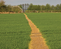
The effect of the case may be that many hundreds, or even thousands, of “lost highways” – unmarked and unused for generations – will be revived and added to the national rights of way network.
The Andrews duo
The context of both Andrews cases was the process of enclosure during the early 19th century. This was the mechanism by which traditional communal farming in open fields was abolished and land was enclosed and put in the ownership of a single owner – an exercise which has been termed “class robbery” by some academics.
In order to facilitate the process of enclosure, Parliament enacted the Inclosure Consolidation Act 1801 (“the 1801 Act”). From this point, the provisions of the 1801 Act could simply be incorporated by reference into any particular local Act, rather than each locality having to start from scratch each time.
One such locality was Crudwell, in relation to which an Act received Royal Assent in 1816 (“the Crudwell Act”). The Act appointed a commissioner in the usual way who enjoyed all the powers provided for in the 1801 Act. This meant that as well as ruling on the enclosure of land, he was able to make provision for certain roads, footpaths, bridleways and other features.
The critical provision in Andrews 2 was section 10 of the 1801 Act, which gave the commissioner the power to “set out and appoint such private roads, bridleways, footways, ditches, drains, watercourses, watering places, quarries, bridges, gates, stiles, mounds, fences, banks, bounds and landmarks in, over, upon and through or by the sides of the allotments to be made and set out in pursuance of such Act, as he shall think requisite”.
In Andrews 1 it was conceded (and accepted by the court) that section 10 only applied to private roads, bridleways, footways, etc. As this was the only provision in the 1801 Act that allowed the commissioner to appoint rights of way of less than 30ft in width, any purported laying down of a public right of way of less than this width was viewed as ultra vires and non-binding.
In the case of the Crudwell Act, the commissioner purported to provide for precisely these types of rights of way – namely a public bridleway of 15ft in width and a further public bridleway of 10ft in width.
The concession made in Andrews 1 would mean that these awards held no validity. Accordingly, Mr Andrews abandoned the concession and argued that, on its true construction, section 10 permitted the award of both private and public rights of way of less than 30ft in width.
Court of Appeal’s reasoning
This might seem to run contrary to the natural meaning of the words, but the Court of Appeal found in Mr Andrews’ favour by reading the 1801 Act in a purposive way. It could see no reason why the 1801 Act would not provide for the setting out of public bridleways and footpaths of any given width.
The court also viewed the 1801 Act in the context of the enclosure process as a whole. The physical landscape of the countryside, the Lord Justices reasoned, “was to be changed in radical ways” and it made no sense that the 1801 Act would not make provision for the network of public footpaths and bridleways to be redrawn to take account of this. Mr Andrews’ expert was able to point to 67 other local enclosure Acts that made provision for public rights of way of less than 30ft in width, and to the fact that there had apparently been no legal challenge to any of these at the time.
The court therefore ruled that the 1801 Act did allow commissioners to award public footpaths and bridleways of any width. The effect of this is that the Crudwell awards fall to be added to the definitive map under the terms of section 53 of the Wildlife and Countryside Act 1981.
During the course of Andrews 2, the court heard that there could be 500 to 1,000 similar instances where public footpaths and bridleways had been awarded by enclosure commissioners but were unrecorded and unused (Mr Andrews’ expert having already identified 67 examples). These rights of way can now be legally used, and there will be a race by ramblers’ associations and others to research them and apply to have them added to the definitive map in advance of the 2026 deadline. Landowners will despair that these long-forgotten ways will be revived, but a trip to the Supreme Court by a new litigant is likely to be necessary to change the position, as the secretary of state is not appealing the Andrews 2 decision.
A final thought
An interesting consideration is what might happen if the route of such a right of way has been built over? Technically at least, any construction could constitute obstruction of a public right of way. It matters not that the rights are not currently shown on the definitive map. The definitive map is only evidence of the ways that are shown on it, not of the ways that have not yet been added. It is anticipated that local authorities and landowners will try to deal with this situation by way of diversion orders if necessary. This leaves open the question of what might happen if a landowner has built over the entirety of a parcel of land affected by a “lost highway”, leaving no room for an alternative route. Potentially a rocky path indeed.
Richard Manyon is an associate at Payne Hicks Beach