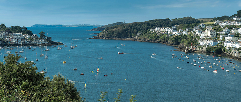
Stuart Pemble examines an adjudication enforcement decision that needed the judge to consider the territorial extent of England.
Key point
- For the purposes of the Housing Grants, Construction and Regeneration Act 1996, England ends at the mouth of a river
The Royal National Lifeboat Institution owns a pontoon at Fowey Harbour in Cornwall, where it moors a lifeboat. The Maritime and Coastguard Agency classifies the River Fowey as a tidal river or estuary (a Category C river in the technical jargon). This means that it does not form part of the sea. And the harbour, according to Judge Stephen Davies in Van Elle Ltd v Keynvor Morlift Ltd [2023] EWHC 3137 (TCC); [2023] PLSCS 206, is also “well inland” of the point where the river meets the sea.
The pontoon was held in place by two berthing piles, which were driven into the river bed. There were also two mooring piles, again driven into the river bed. The mooring piles were not connected to the pontoon, but were used by the RNLI to secure the lifeboat. Keynvor Morlift was employed by the RNLI to replace all of the piles, a contract which included the removal and reinstatement of the pontoon. In 2021, Keynvor Morlift entered into a sub-contract with Van Elle for the installation of the replacement piles.
In 2023, Van Elle won an adjudication against Keynvor Morlift and was awarded £335,000. Keynvor Morlift disputed the adjudicator’s jurisdiction, arguing that because the works were carried out below the river’s low-water line, they were not construction operations in England. In order to decide the jurisdictional challenge, Judge Davies had to ask the question: where does England end?
England, my England
Noting that there is “no definition of England, Wales or Scotland” in the Housing Grants, Construction and Regeneration Act 1996, the judge had to consider a wide range of sources, essentially to establish what the legal “extent of the realm” actually was:
1. The Interpretation Act 1978, which states that “England means, subject to any alteration of boundaries under Part IV of the Local Government Act 1972, the area consisting of the counties established by section 1 of that Act, Greater London and the Isles of Scilly”, and that land covered by water still counts as land.
2. Ordnance Survey election maps, which show Cornwall straddling the River Fowey on both sides.
3. The OS boundary line information document (available online), which clarifies which structures in the sea tend to be included in the extent of the realm.
4. The Territorial Waters Jurisdiction Act 1878 and Territorial Waters Order in Council 1964, which in turn have been superseded (perhaps in part rather than in whole) by the Territorial Sea Act 1987 and Territorial Sea Baselines Order 2014 as well as the United Nations Convention on the Law of the Sea (as modified by the 2014 Order). Baselines are the line or curve establishing the edge of the realm, often following the low-water line of the coast in question.
Unfortunately, but perhaps not surprisingly, this diverse collection of sources was not as helpful as the judge might have hoped: “Having undertaken… lengthy analysis, I must conclude… by stating that nothing in this tangle of Acts, OS maps, supporting explanations, conventions or orders seems to me to be determinative of the question of what is meant by England on a proper construction of the… [1996] Act…”
Rather, the judge felt that the answer lay in considering the 1996 Act in the context (where appropriate) of all of the sources.
A corner of a Cornish harbour that is forever England
Section 105(1) of the 1996 Act and the 1978 Act were key. Section 105(1) made it clear that construction operations undertaken in relation to an enclosed area of water would be construction operations in England. That approach was supported by the 1978 Act: as mentioned above, “unless any contrary intention appears, land includes land covered with water”. Taking both together, and picking key points from the other sources, he concluded that England extended to the mouth of the river: “…references to ‘the land’ in s105(1) include land covered by water and, hence, land covered by inland waters up to the baseline which, in the case of rivers such as the River Fowey, extends to the mouth of such rivers.”
The judge also noted that this was not inconsistent with an earlier decision of Judge Richard Havery QC – Staveley Industries plc (t/a EI.WHS) v Odebrecht Oil & Gas Services Ltd [2001] PLSCS 60 – because that dealt with a different point regarding whether structures in the seabed below the low-water mark formed part of the land (Judge Havery held that they did not).
So, England ends at the mouth of the river and the pontoon was upriver from that. Because land includes land covered with water, the works to the pontoon were therefore caught by the 1996 Act and the jurisdictional challenge failed.
Alleged breaches of natural justice
Keynvor Morlift also argued that the adjudicator had breached the rules of natural justice because he had failed to take account of various defences it had raised. The judge referred to Coulson J’s judgment in Pilon Ltd v Breyer Group plc [2010] EWHC 837 (TCC), which had stressed that a failure by an adjudicator to address a matter in issue has to be deliberate and material. Coulson J had also noted that such challenges rarely succeed.
Judge Davies had little difficulty in deciding that this was not one of those rare cases. The worst that could be said of the adjudicator was that there had been “modest and unintentional oversight”, with one of the challenges being described as “misconceived” and “spurious”.
Stuart Pemble is a partner at Mills & Reeve


