

 How much easier would it be if you could show local residents a 3D model of your scheme in the existing landscape, so they could see what it looked like from street level or from their bedroom window?
It would make things easier, particularly in the earlier stages of planning, right?
The technology is already there and is being used to a small degree, but expanding the use of 3D modelling is an exciting prospect for London’s planning consultants and advisers.
Deloitte Digital’s disruptor Ed Greig says: “From an architectural point of view, 3D is a no-brainer.”
Greig is working with a developer in Brixton on an urban renewal project. “They want us to 3D scan the estate and show it relative to what Lambeth’s new plans are. The 3D image can help locals understand the plans. From a planning point of view it will be a powerful tool.”
Bidwells partner Mike Derbyshire, a planner for more than 25 years, can see the benefits, particularly as you can take a 3D visualisation into the room with the planners. “How do you represent a building that isn’t there, how do you convince a sceptical planner or residents? With a 3D visualisation you can discuss it with the planner and change things.”
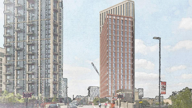
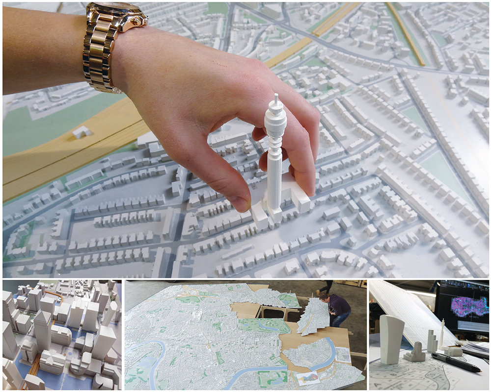
Individual buildings and perhaps bigger schemes are one thing, but what if there was a 3D model of the whole of central London? What about if you could show planners how your tall building would affect the local landscape, where shadows would fall, how it would look from a fourth-floor window in the building opposite and how it would sit within sightlines?
You could drop your building into place within the model and immediately see how it fits into the existing landscape.
Parts of the city have already been 3D mapped, and Shaun Andrews, head of London strategy at GL Hearn, reckons that a comprehensive model of London is only five years away. “This will have a big impact on discussions and negotiations on things such as visual impact. The benefit would be early testing.”
And what if that model was overlaid with certain data? Now the data options are many. Data is another big game changer for planning and development and in particular spatial planning.
A few years ago TfL started releasing its travel data. The introduction of the Oyster card meant that bus, tube and train journeys could be mapped and analysed, and this has spawned a myriad of travel apps, but it is just one source of data. Retail landlords, for example, are using Bluetooth technology to gather information about visitors to their schemes, as are those that provide free WiFi in their stores and public places. It is just the tip of the iceberg.
“In the old days it was a census every 10 years, but now you’ve got data on everything. The wealth of data helps policymakers plan more intelligently,” says Iain Painting, senior planning director at Barton Willmore. “Data and technology are essential and we tap into only half of it.”
Andrews agrees. He says: “The arrival of ‘big data’ – quality data around almost every aspect of London life – will revolutionise the basis on which planning policies are developed and decisions are made.”
He points out that using one of the many mobile phone travel apps, you could sit in a meeting and research quite complicated route scenarios to determine travel options and movements to different locations.
Adding in such information to a 3D model suddenly brings another level of intelligence to planning.
Ask a planning adviser about all the policy designations that have to be taken into consideration and they will quickly reel off a dizzying list: rights to light, housing zones, and sightlines to name just three
“If you had a 3D program that covered the whole of London and overlaid all that information, it would be a fantastic tool for developers and local authorities,” says Ian Rennie, a director in CBRE’s planning team.
Andrews agrees, saying that you could almost make the London plan three-dimensional. “You can see a time when planning applications are 3D and sit in the 3D model and you can run the smart data impacts.”
London needs a data champion, Derbyshire suggests.
All this is very exciting, but of course there are caveats in this brave new world of technology. Such models are expensive, and while a comprehensive model of London would be a game-changer, the question of who pays for it has yet to be resolved.
Derbyshire also points out that 3D models have to be verified, and convincing people they are accurate when there is often scepticism is another barrier to overcome.
With smart data, the concerns are about accuracy, particularly when there is so much money invested in a development. And, as Barton Willmore’s Painting points out, you just can’t rely on us humans to be predictable. We are erratic beasts.
So there has to be confidence in the information and in the technology, but progress isn’t going to slow and neither is the potential to make more informed and quicker decisions about London’s planning.
stacey.meadwell@estatesgazette.com