


In cities around the world streetlights are monitoring traffic flow to alleviate congestion, sensors are guiding drivers to empty parking spaces and London towers are being used as drone ports.
These technologies have the power to be game changers. But how smart are they as standalone innovations? Arguably, not very. A truly smart city thrives on connectivity.
While piecemeal solutions don’t have the reach to create city-wide intelligent networks, it’s a totally different story if they are embedded into the existing urban infrastructure.
A drone is a drone. A fleet of drones flying between ports on otherwise redundant building rooftops creating an airborne delivery service is a model for the future.
“When building new transport corridors in cities now, we should be thinking about what may replace present day technology in the future,” says James Stewart, KPMG’s global infrastructure chairman.
“When designing and developing new high-speed train lines, we should also be thinking about how we would use the same land and space to also accommodate a hyperloop line or maybe a drone corridor.”
The problem is that urban planning systems are often complex, bureaucratic and fraught with hurdles. Introducing the strategies required to rethink infrastructures with future tech advances in mind is unlikely to prove any less challenging.
However, governing bodies are realising the power of connected digital states and cities. And they are starting to act.
State-wide connectivity in Pennsylvania
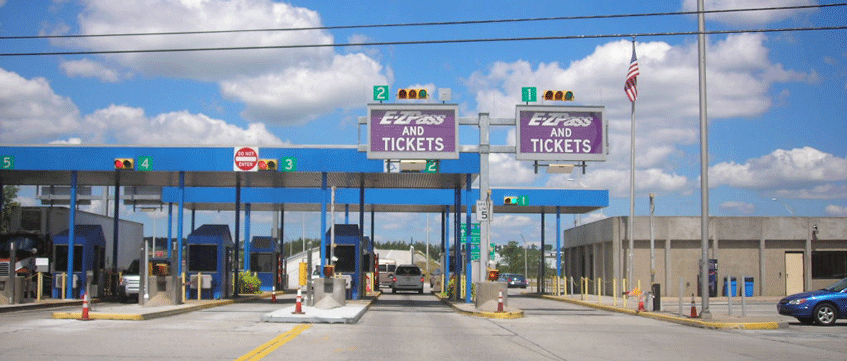
Plans to use the 550-mile Pennsylvania turnpike running east-west near the state’s southern border into a route along which to run 288 strands of fibre-optic cable are afoot.
The Pennsylvania Turnpike Commission is currently evaluating bids from consortiums gunning for the broadband public-private partnership project.
The cable will likely lie on the side of the highway and will not only deliver high-speed connectivity throughout the state, but will connect all of the toll booths along the route with central computers.
Pipe mapping in Chicago
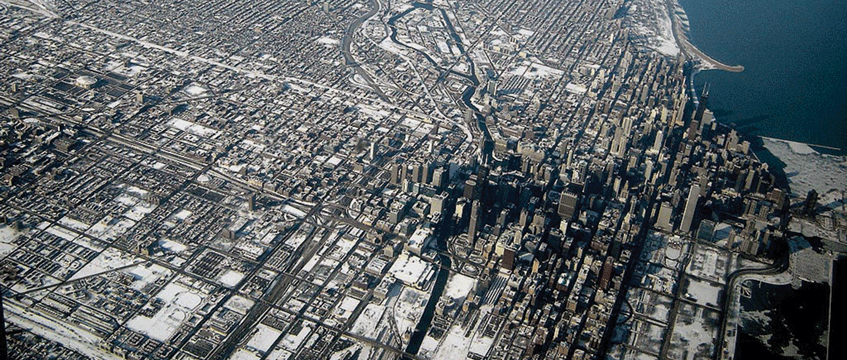
Chicago is trialling a 3D-mapping platform to create a visual network of it’s underground pipeline network of sewer, water, electricity, gas, broadband and other services from more than 30 companies and utilities.
Developed by Chicago-based innovation accelerator UI Labs, the goal is to cut down the amount of time it takes construction and maintenance workers to locate and ascertain the depth of subterranean infrastructure. Users can upload live data for access to the location and key information about all installations in a given area.
The system will help cities overcome the problem of recording, locating and maintaining underground utility data by converting photos, digital drawings and existing mapping information into a single format and storing them in a central database linked to a 3D city map.
It has been mooted that city excavation permits be made conditional on companies supplying photographs of all the underground infrastructure they uncover.
Sicilian Valley status in Catania

The city of Catania in Sicily dates back nearly 3,000 years, but that has not stopped it from becoming one of only 5% of cities around the world to introduce a municipality-wide app.
A prime example of how, with the right government support, urban hubs that are not considered world leaders can implement infratech without much financial backing in the first instance.
Developed by the University of Messina, Catania’s SmartMe app was built off the back of a modest crowdfunding raise in 2015.
Now it successfully knits together a formerly sprawling city population via an app that responds to specific local needs.
It has a function that signals potholes – a real problem in countries where there is less investment in infrastructure repair and improvement.
It also connects sensored rubbish bins that send an alert to the sanitation department when they are full and has sensor-equipped bus stops which monitor heat, humidity and sound.
The local government is now looking to invest a portion of the €13m needed to roll the technologies out across other Sicilian cities including the capital Palermo.
Similar city apps and digital plans have been introduced in Barcelona, Singapore and Porto.
Dual-use car parks in Cincinnati
From driverless cars to ride-sharing and Uber, the car park could soon be facing obsolescence.
The problem is that, until then, we still need them. Conversions are one thing, but existing car parks have not been designed to be easily repurposed.
The answer could be to build in dual use from the word go.
Global design practice Gensler’s three-level parking structure at the 84.51 building in Cincinnati, Ohio, is a prime example of the strategy in practice.
A parking structure that can be quickly and cheaply converted into a traditional office space.
Above-ground parking with higher ceilings, horizontal rather than the traditionally slanted floors, and exterior rather than interior ramps, are all part of the process.
Rooftop drone ports in London
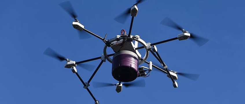
From urban farms to fisheries and beehives, the conundrum over the best – and most financially viable – use for redundant high-rise rooftops in high density locations around the world has long been debated. But putting them to use as launchpads for a network of drone ports makes sense.
Skyports is doing just that in London where it already has ports on the roofs of 15 building across the city from Battersea to Clerkenwell as it gears up to facilitate a growing demand for aerial delivery and, eventually, passenger movement.
Landlords will be able to generate revenue by putting the space to good use. Skyports covers the planning and construction costs as part of the deal.
Internet voting in Tartu
Infrastructure improvements are sometimes just as much about keeping people off city streets and travel networks as on them.
Particularly at busy times that can be planned for, such as elections.
The city of Tartu in Estonia is leading the way in implementing the country-wide internet voting system.
Introduced back in 2005 it was initially only used for local elections before being rolled out to cover general and European parliament elections. In the 2017 general elections more than 30% of votes were cast via the i-voting channel.
Smart street lights in San Diego

San Diego’s $30m programme to fit 3,200 streetlights with sensors comes off the back of the replacement of 35,000 streetlamps with LED lights.
The intelligent lighting network, which can sense sound and light, is being used to track footfall and congestion and to help law enforcement.
The first phase of the streetlight network programme will cover 160 square miles – approximately half of the city.
To send feedback, e-mail emily.wright@egi.co.uk or tweet @EmilyW_9 or @estatesgazette